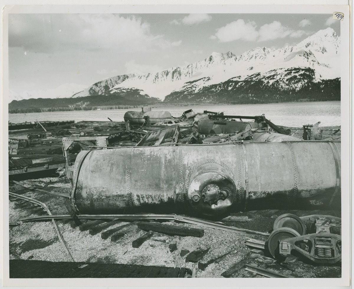
At thirty-six minutes past three in the morning UTC on the twenty-eighth of March, nineteen sixty-four, a magnitude nine point two earthquake struck about one hundred and twenty kilometers east of Anchorage. It generated a major tsunami. Local exceeded thirty meters along Alaskan shorelines, and in Valdez harbor reports put it above sixty meters, possibly helped by a landslide. Where did the wave stop?
It did not stop at Alaska. The tsunami struck the southeast coast of Alaska, British Columbia, the United States West Coast and Hawaii, then across the Pacific. Damage came to an estimated one billion dollars, and more than one hundred and thirty people died. An earthquake in one corner of the ocean delivered its consequences to coastlines on the far side of it.
The earthquake struck at thirty-six minutes past three UTC on the twenty-eighth of March, nineteen sixty-four, which was the evening of the twenty-seventh locally. It measured magnitude nine point two, about one hundred and twenty kilometers east of Anchorage. The tsunami it generated hit the southeast coast of Alaska, British Columbia, the United States West Coast and Hawaii.
Close in, the numbers are hard to picture. Local runup exceeded thirty meters along Alaskan shorelines, and a National Research Council report records runup over sixty meters in Valdez harbor, possibly due to an associated landslide. Runup is a product of the coast as much as the wave, which is why one harbor can double the figure for an open shore.
The wave then propagated across the Pacific. Damage came to an estimated one billion dollars and more than a hundred and thirty people died, a toll spread across coastlines thousands of kilometers from the fault that moved.
What NOAA uses the event for now is a comparison. In nineteen sixty-four there was no real-time deep-ocean detection, so the model of that tsunami is constrained by the seismic source location and two records, at Yakutat and Kahului. A forecast today is constrained by data within an hour of the earthquake, which turns a reconstruction into a warning.
wat. Sixty meters of water in Valdez harbor, and the same wave still doing damage on the other side of the Pacific.
wat wat
The same page is a comparison of eras. In nineteen sixty-four there was no deep-ocean detection at all; a forecast today is constrained by deep-ocean data within an hour of the earthquake.
How do we know?
The NOAA Center for Tsunami Research published a model of the nineteen sixty-four event built with its forecast tools, alongside the earthquake parameters and the historical record of runup and damage.
What is still unknown
NOAA labels the model a research product and not an official forecast. The source model for nineteen sixty-four is constrained only by the seismic location and two tide gauge records, at Yakutat and Kahului.
Learn something?
Where to next
 How high can a wave reach if the water has nowhere to go?tsunami
 What did geologists see in nineteen oh six that they could not explain?earthquake
 What are the stacks of white bubbles frozen into a northern lake?alaska