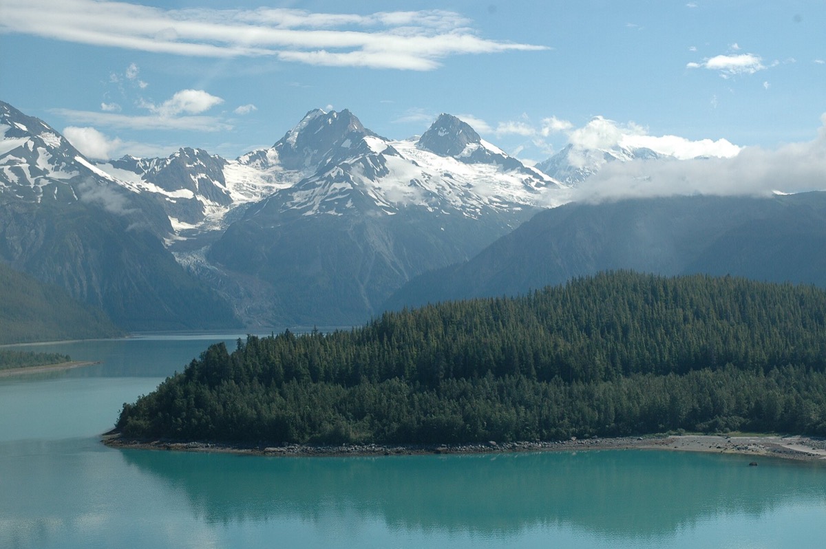
Lituya Bay is a T-shaped tidal inlet on the northeast shore of the Gulf of Alaska, and it heads in the trench along the . In July nineteen fifty-eight the fault moved. The arm at the head of the bay is deep, steep-sided and narrow, which turns out to be the worst possible shape for what happened next.
Over five hundred meters, on the slope opposite the impact. Displacement along the fault triggered a rockslide of into deep water in . The water it displaced surged to an altitude of one thousand seven hundred and forty feet on the spur facing it. The slide also generated a that ran the length of the bay.
The setting does the damage. Lituya Bay is a T-shaped tidal inlet on the northeast shore of the Gulf of Alaska. Its head lies in the trench along the Fairweather fault, with two arms branching at the top of the T. Deep water, steep rock walls and a confined space are the three ingredients.
On the ninth of July nineteen fifty-eight, local time, displacement along the fault during the earthquake triggered a rockslide into deep water in Gilbert Inlet, one of those two arms. The volume was forty million cubic yards.
Two things followed. The displaced water surged to an altitude of one thousand seven hundred and forty feet on a spur opposite the point of impact, which is the figure the event is remembered for. And the slide generated a gravity wave that swept seven miles to the mouth of the bay at a speed probably between ninety-seven and a hundred and thirty miles per hour.
The evidence is written on the shoreline. The surge and the wave destroyed the forest on the shores over an area of four square miles, which is how the altitude could be mapped afterward. In the outer part of the bay two of three fishing boats sank, and two people were killed.
wat. The water went one thousand seven hundred and forty feet up the opposite slope, and stripped the forest to that line.
wat wat
The number is not a wave height in any ordinary sense. It is a measurement of how far up a mountainside water was thrown by a landslide dropping into a confined inlet.
How do we know?
Don Miller’s report in the Bulletin of the Seismological Society of America. It traces the displacement along the Fairweather fault, the volume of the rockslide, the altitude of the surge and the damage along the shores.
What is still unknown
The surge altitude was mapped afterward from the trimline of destroyed forest rather than measured as it happened. The wave speed is given as a range, probably between ninety-seven and a hundred and thirty miles per hour.
Learn something?
Where to next
 How far does a tsunami from Alaska actually travel?tsunami
 What are the stacks of white bubbles frozen into a northern lake?alaska