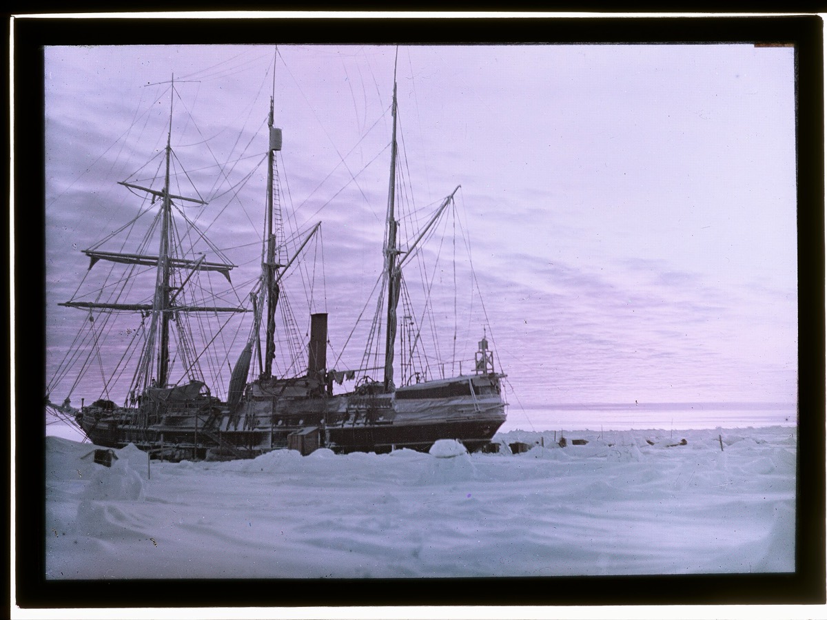
Ernest Shackleton’s Endurance was trapped and crushed by ice and sank in the Weddell Sea in nineteen fifteen. Captain Frank Worsley registered a position before she went down. The problem with searching there is the ice itself: winds and currents can compress huge masses of it within hours, closing open channels and throwing up impassable even to icebreakers. How did the Endurance22 expedition get through?
With radar from orbit. The German Aerospace Center supplied satellite images, which show structures in the sea ice through cloud and at night because the radar antenna supplies its own illumination. The expedition used every flyover to pick a daily course through the labyrinth of channels, sometimes receiving images several times a day. Algorithms also calculated in high resolution.
Shackleton’s ship sank in nineteen fifteen after being trapped and crushed by the ice of the Weddell Sea. The crew survived, and the rescue that followed turned the whole venture into a legend. The wreck stayed lost for over a century, in a sea where the surface conditions change faster than a ship can cross them.
Sea ice is the obstacle and the subject. Winds and ocean currents can compress large masses within hours and close open channels, and ice under pressure throws up ridges that even icebreakers cannot pass. Radar satellites such as TerraSAR-X show the different structures in the ice, through cloud and in darkness, which makes them extremely valuable for navigation in polar regions.
The Endurance22 expedition sailed from Cape Town in early February of two thousand twenty-two aboard the icebreaker and research vessel S.A. Agulhas II. Two researchers from the German Aerospace Center were on board, using every TerraSAR-X flyover to acquire images. Algorithms from a laboratory in Bremen calculated sea ice drift at high resolution, and a ground station in Neustrelitz supported the work.
They found the Endurance at a depth of three thousand and eight meters, about six and a half kilometers south of the position Worsley recorded in nineteen fifteen. The wooden wreck lies upright and in excellent condition, with the lettering on the stern still clearly visible. It will not be salvaged, being protected under the , so the team documented it in photographs, video and three-dimensional images instead.
wat. The ice that crushed her is the same ice they had to read from orbit to find her again.
wat wat
The satellite work was not built for shipwrecks. Classifying sea ice for navigability is a live problem for every vessel operating in polar waters, and the search was a test of it.
How do we know?
The German Aerospace Center reported on its own contribution to the Endurance22 expedition, including the satellite imagery, the sea ice research carried out on board and the condition of the wreck.
What is still unknown
An agency account of its own role, written days after the find. It describes what the imagery enabled rather than evaluating how much of the success rests on it.
Learn something?
Where to next
 What is the human body unusually good at?endurance
 Does beetroot juice actually make you faster?endurance
 What would make low orbit unusable without a single new launch?satellites